Posts: 7,844
Threads: 37
Joined: Jun 2016
Reputation:
216
01-27-2017, 10:24 AM
(This post was last modified: 01-27-2017, 10:24 AM by danbrotherston.)
(01-27-2017, 12:58 AM)GtwoK Wrote: To play devil's advocate here... Really? I mean, the trail just cuts across a single block. The detour would be to just follow the sidewalk a couple meters to the right, wouldn't it? Am. I missing something? If they blocked off the trail heading through the the woods, or Victoria Park, or somewhere where the detour was not immediately obvious, I'd understand, but detouring around this just requires a slight turn to your right and is immediately obvious, and only adds maybe 20 seconds to your journey.
For pedestrians perhaps. But on a bicycle I am not legally permitted to ride on the sidewalk. So now I have to choose between biking on a snow covered road, or breaking the law.
It isn't about the time added. In fact, in the summer I generally don't use that portion of the trail because riding up Park is actually faster.
But on snow covered roads, with snowbanks in the bike lanes, I'd prefer to take the extra time to ride the trail and feel and be much safer.
I do realize it's a relatively small detour, on relatively bikeable roads. But for anyone uncomfortable riding on the road, it might very well be an insurmountable (and unexpected) barrier.
Posts: 434
Threads: 2
Joined: Jun 2015
Reputation:
57
(01-27-2017, 07:21 AM)ijmorlan Wrote: The point is that we have another example of the double standard. If it were a road, there would have been signs for a week or two ahead of time advertising the closure
Ha ha ha. No.
Posts: 1,204
Threads: 0
Joined: Mar 2015
Reputation:
37
(01-27-2017, 07:21 AM)ijmorlan Wrote: The point is that we have another example of the double standard. If it were a road, there would have been signs for a week or two ahead of time advertising the closure, and there would have been an (admittedly poorly) signed official detour route.
I think you're giving more credit than is due. If this was a road, a sign would go up Friday evening after rush hour, pylons would be lined up Sunday night, and it would be closed on Monday morning.
Posts: 7,844
Threads: 37
Joined: Jun 2016
Reputation:
216
(01-27-2017, 12:15 PM)timc Wrote: (01-27-2017, 07:21 AM)ijmorlan Wrote: The point is that we have another example of the double standard. If it were a road, there would have been signs for a week or two ahead of time advertising the closure, and there would have been an (admittedly poorly) signed official detour route.
I think you're giving more credit than is due. If this was a road, a sign would go up Friday evening after rush hour, pylons would be lined up Sunday night, and it would be closed on Monday morning.
I don't think I am. If your residential cul-de-sac is closed, you get signs on Friday, pylons after rush hour sure. But homeowners on the street would get flyers etc.
The IHT is not a residential cul-de-sac. It's equivalent to Fischer-Hallman Rd. in terms of trails, it's the main through route in the city.
If Fischer-Hallman Rd. was going to be closed to all traffic for an extended period of time, between say, Columbia and the Plaza, you had better believe there would be notifications for weeks, it would probably be in the paper multiple times.
Posts: 4,442
Threads: 1
Joined: May 2015
Reputation:
204
(01-27-2017, 12:29 PM)danbrotherston Wrote: (01-27-2017, 12:15 PM)timc Wrote: I think you're giving more credit than is due. If this was a road, a sign would go up Friday evening after rush hour, pylons would be lined up Sunday night, and it would be closed on Monday morning.
I don't think I am. If your residential cul-de-sac is closed, you get signs on Friday, pylons after rush hour sure. But homeowners on the street would get flyers etc.
The IHT is not a residential cul-de-sac. It's equivalent to Fischer-Hallman Rd. in terms of trails, it's the main through route in the city.
If Fischer-Hallman Rd. was going to be closed to all traffic for an extended period of time, between say, Columbia and the Plaza, you had better believe there would be notifications for weeks, it would probably be in the paper multiple times.
When I wrote that, I was thinking of closures like King and William and other ION-related closures. Speaking of which, ION also has a double standard for roads vs. trails in terms of quality of detour planning and care taken to minimize closures.
Posts: 7,844
Threads: 37
Joined: Jun 2016
Reputation:
216
(01-27-2017, 06:11 PM)ijmorlan Wrote: When I wrote that, I was thinking of closures like King and William and other ION-related closures. Speaking of which, ION also has a double standard for roads vs. trails in terms of quality of detour planning and care taken to minimize closures.
Well that's a reasonable point. But I think while the particular closures might change day to day, or even hour to hour, it's pretty well known that the area is under construction.
And when a major closure like Victoria St. at King takes place, there are signs for weeks. Even King and William had quite a bit of advance notice of the closure.
Posts: 4,442
Threads: 1
Joined: May 2015
Reputation:
204
(01-27-2017, 07:32 PM)danbrotherston Wrote: (01-27-2017, 06:11 PM)ijmorlan Wrote: When I wrote that, I was thinking of closures like King and William and other ION-related closures. Speaking of which, ION also has a double standard for roads vs. trails in terms of quality of detour planning and care taken to minimize closures.
Well that's a reasonable point. But I think while the particular closures might change day to day, or even hour to hour, it's pretty well known that the area is under construction.
And when a major closure like Victoria St. at King takes place, there are signs for weeks. Even King and William had quite a bit of advance notice of the closure.
Yes, that’s what I mean — a major road gets pretty good advance warning, and may even get decent detour signage. Close a major trail, though, and maybe there is nothing, maybe there is some little bit of warning. Same goes for re-routing for the convenience of a developer — try buying properties on both side of Fischer-Hallman and see how accommodating the Region is in re-routing the road around your property. But if it’s the Iron Horse Trail — no problem!
Posts: 419
Threads: 1
Joined: Jun 2015
Reputation:
32
Complaining here, though cathartic, probably isn't helpful. Complaining to councillors, though perhaps too late for this issue, will put you in their minds when next something comes up.
Isn't there a directory of who's who that we can use to mount a calling campaign? 2017 is looking like it will be a year of activism, so we might as well join in.
Posts: 6,905
Threads: 32
Joined: Oct 2014
Reputation:
224
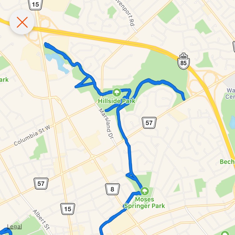
After discovering the joy of winter cycling, I finally explored some of the trails in Northeastern Waterloo that I'd been meaning to check out since the summer.
Weber had always been the "end of the line" for me when heading out that way - with no obvious way to cross here, I'd simply turn around and go back. There wasn't much traffic early this morning, so it wasn't a problem.
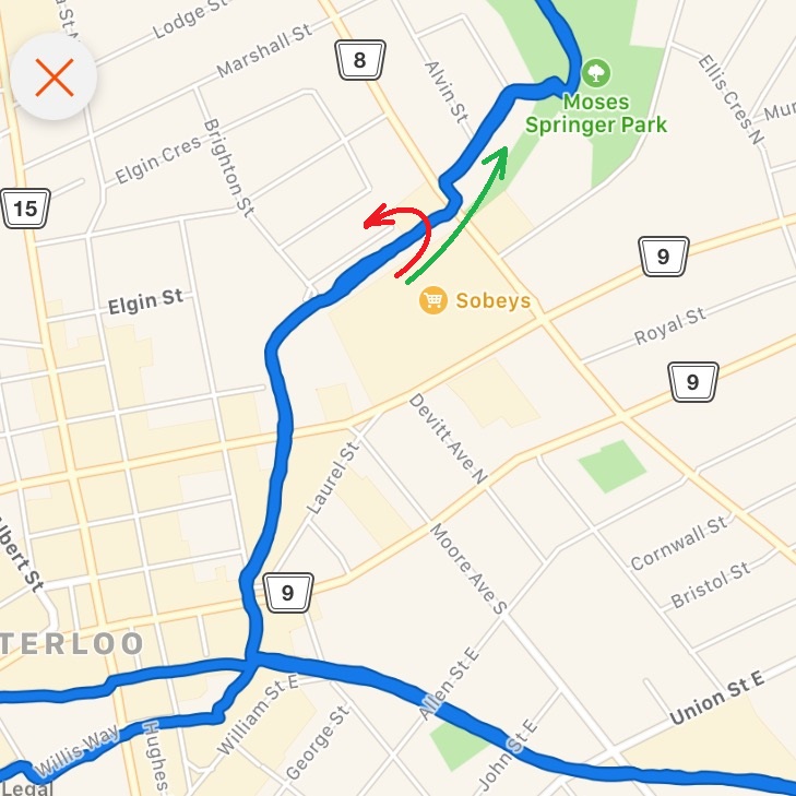
Here's the trails I'm talking about.
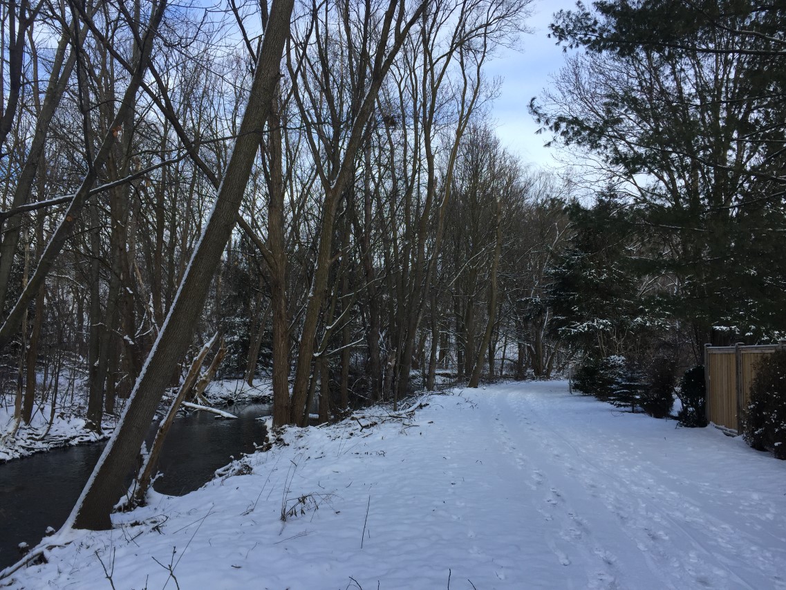
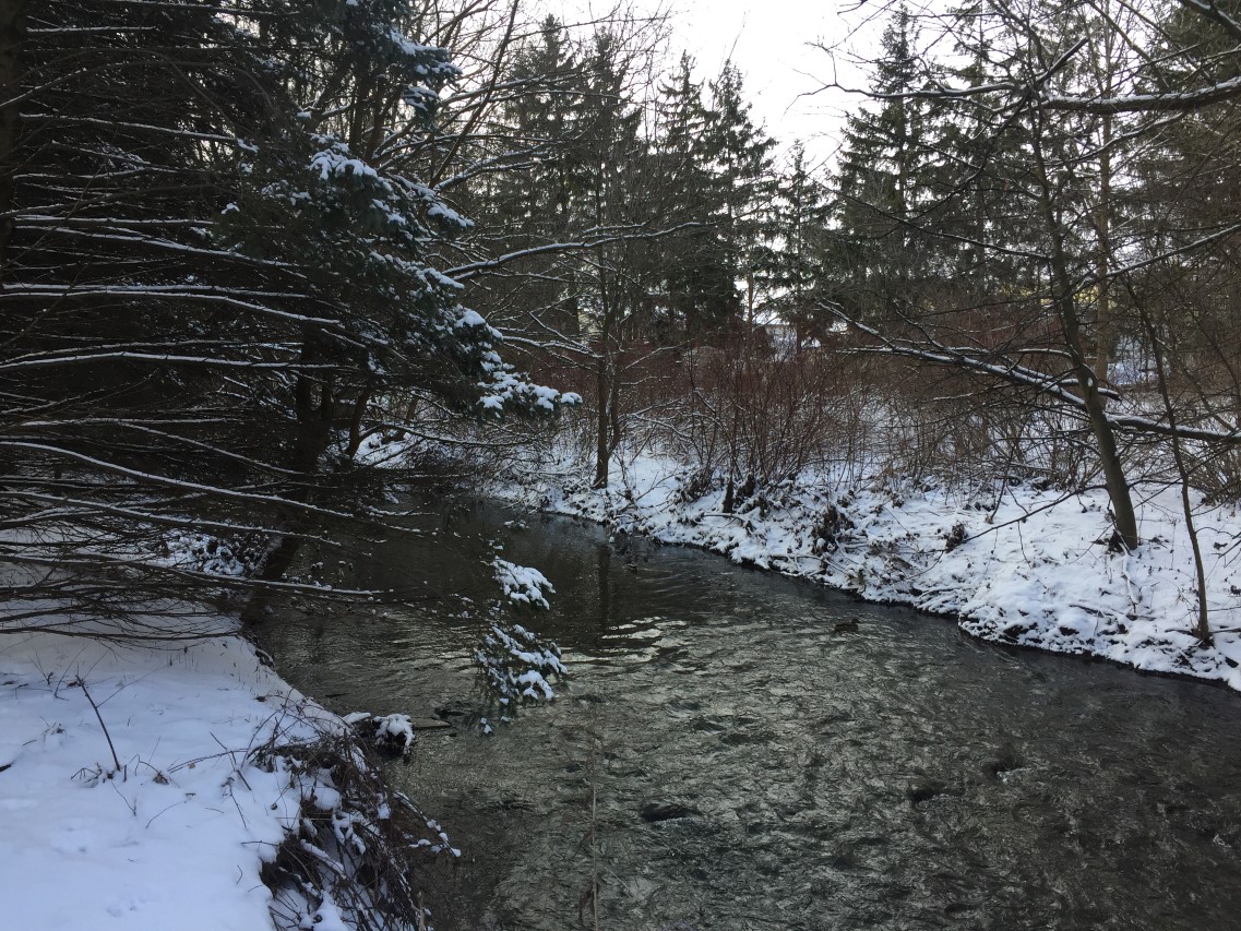
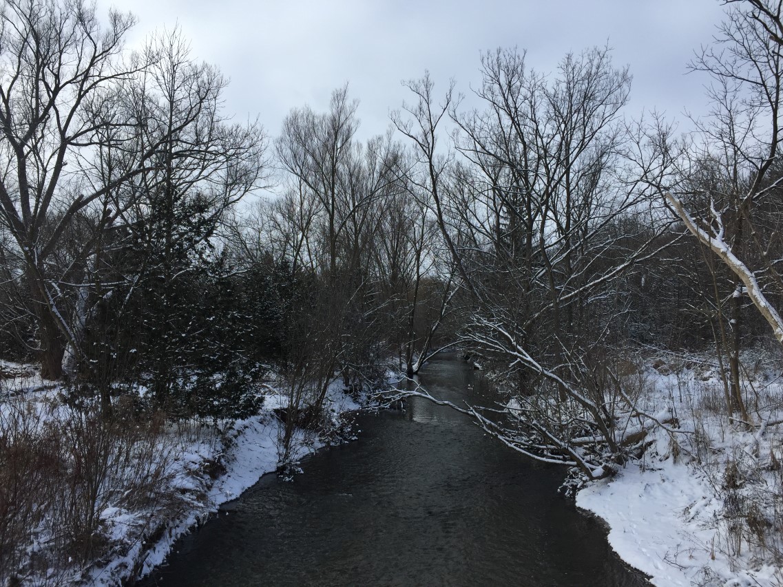
The scenery is lovely along here - lots of creeks and bridges. A few backyards - but other than that, you'd hardly believe you're in a city.
Posts: 6,905
Threads: 32
Joined: Oct 2014
Reputation:
224
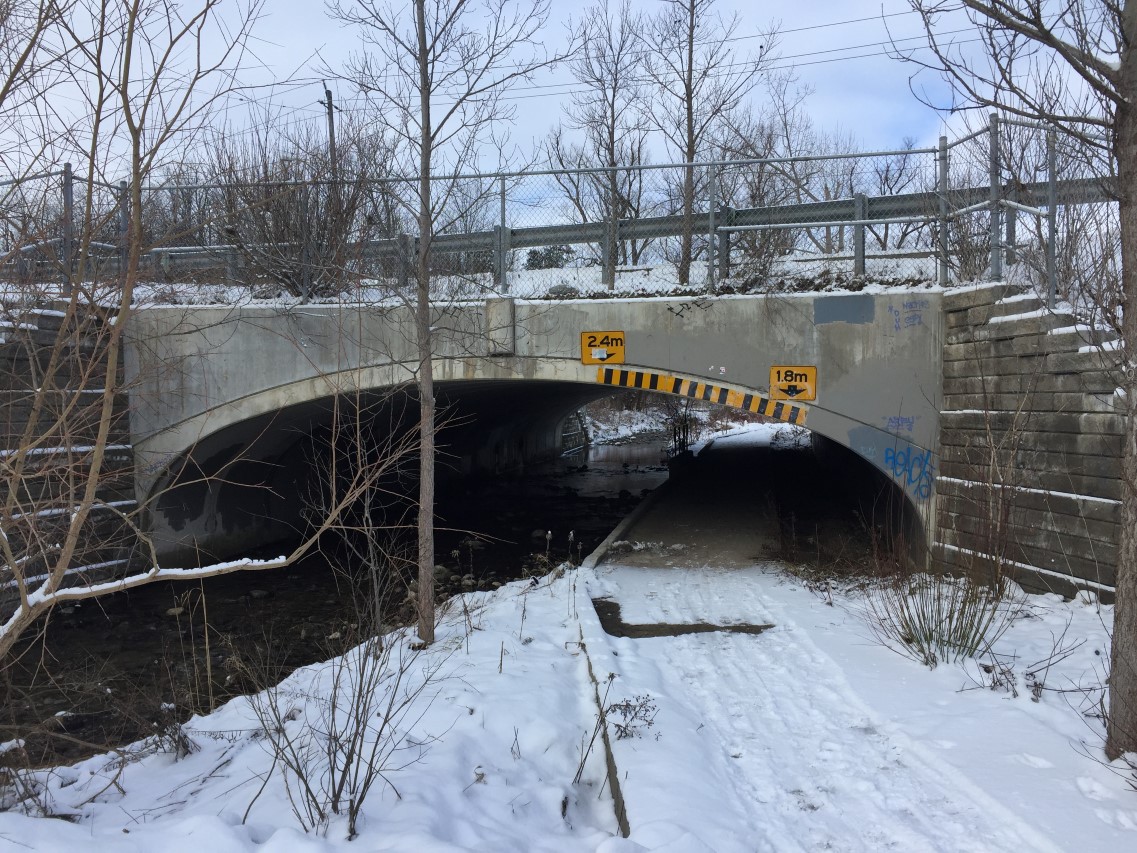
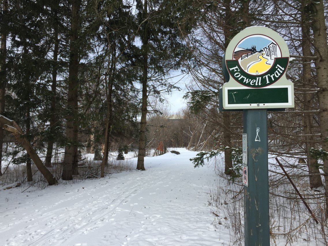
Further along, around Lexington, I believe - I was very surprised to see a "London Solution" tunnel! London, Ontario has these everywhere on their waterfront trail system... I I had no idea we had any in Waterloo Region!
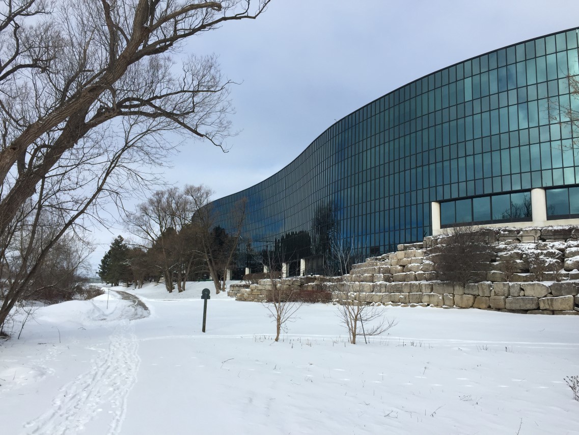
I also never realized just how beautiful the "back side" of Manulife is:
It was about here that I stopped again, and tried to figure out where else I could go. It was not immediately obvious to me how I could get up to Conestoga (I was hoping to go so far as to check out the LRT construction) - but wasn't quite ready to brave trying to ride on Weber, here:
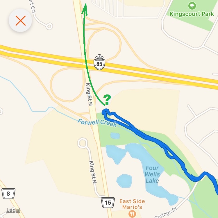
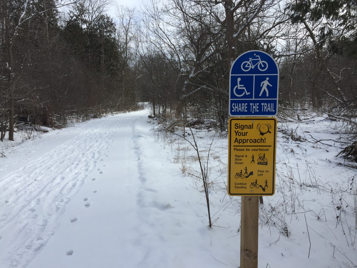
...so back I went. I love these signs - much nicer than the passive-aggressive campaign of signs someone put up along the Iron Horse Trail in Kitchener last summer! These should be standard throughout the Region.
Posts: 6,905
Threads: 32
Joined: Oct 2014
Reputation:
224
Posts: 2,163
Threads: 17
Joined: Sep 2014
Reputation:
77
(01-29-2017, 05:08 PM)Canard Wrote: It was about here that I stopped again, and tried to figure out where else I could go. It was not immediately obvious to me how I could get up to Conestoga (I was hoping to go so far as to check out the LRT construction) - but wasn't quite ready to brave trying to ride on Weber, here:
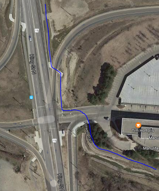
Clearly a bit of a missed connection. King St has MUTs on either side now.
The trails are so close to each other, but you wouldn't know it when you're there.
You just do this, and it's a breeze to get up to the mall.
Posts: 7,844
Threads: 37
Joined: Jun 2016
Reputation:
216
There is a MUT along the East and West sides of King St. from the mall, south to Weber St. This allows access up to the mall from the location where Canard turned back. Connections are far from obvious, but it does exist. It is frustrating that even when trails are within meters (yes, single digit meters) of each other, connections are not clear or obvious or even not on a awkward piece of sidewalk and (illegal to use) crosswalk.
Posts: 6,905
Threads: 32
Joined: Oct 2014
Reputation:
224
(01-29-2017, 05:55 PM)Markster Wrote: Clearly a bit of a missed connection. King St has MUTs on either side now.
The trails are so close to each other, but you wouldn't know it when you're there.
You just do this, and it's a breeze to get up to the mall.
Thank you!! I figured there must be some way to get up there. Sounds like I have a plan for next weekend. 
Posts: 2,163
Threads: 17
Joined: Sep 2014
Reputation:
77
(01-29-2017, 05:56 PM)danbrotherston Wrote: There is a MUT along the East and West sides of King St. from the mall, south to Weber St. This allows access up to the mall from the location where Canard turned back. Connections are far from obvious, but it does exist. It is frustrating that even when trails are within meters (yes, single digit meters) of each other, connections are not clear or obvious or even not on a awkward piece of sidewalk and (illegal to use) crosswalk.
And now that I look at it, I see that they did "connect" the trails. There's a concrete sidewalk that connects them together. Though it means waiting at the traffic light to go north.
I've taken that trail south on King before, and it never occurred to me that that there was another trail so nearby.
|


