Posts: 252
Threads: 1
Joined: Sep 2014
Reputation:
9
Yesterday on my ride home the construction workers were allowing us to walk our bikes across Seagram (lots of trenches dug already so would have been impossible to ride). This morning I tried to walk the bike across and the construction worker said we had to go up to University for the pedestrian crossing. So the only way of getting from one side of Waterloo Park to the other (or one side of Seagram to the other) is now either University Ave, or the crossing south of the lake.
Posts: 6,905
Threads: 32
Joined: Oct 2014
Reputation:
224
09-09-2016, 09:46 AM
(This post was last modified: 09-09-2016, 09:46 AM by Canard.)
What did it look like they were doing at the crossing?
Posts: 252
Threads: 1
Joined: Sep 2014
Reputation:
9
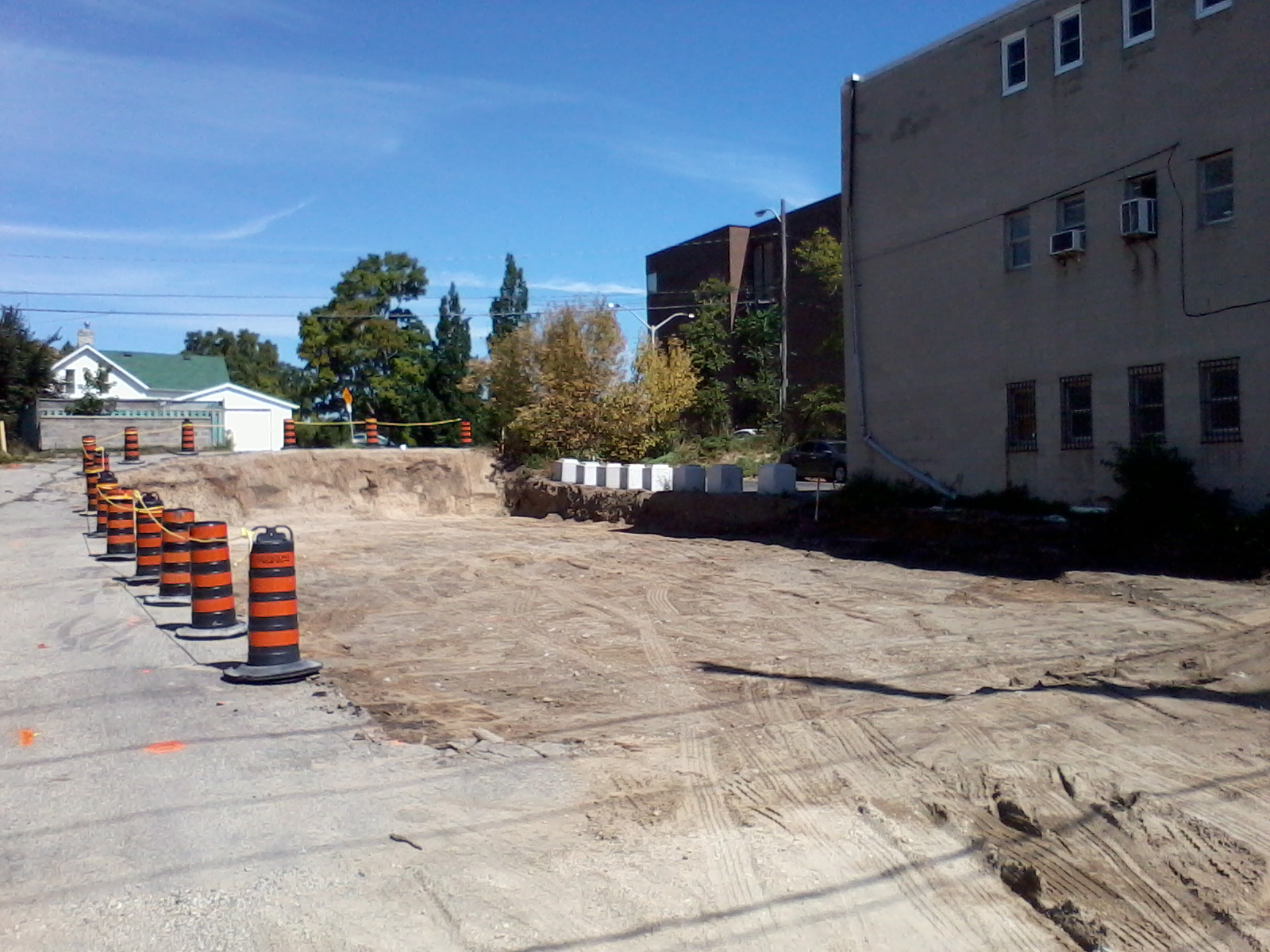
They've dug small trenches around the tracks, preparing to pour concrete maybe? Hopefully whatever work they're doing will also include repaving the Laurel Trail between Seagram and University, which has been out of commission all summer.
Posts: 10,628
Threads: 67
Joined: Sep 2014
Reputation:
348
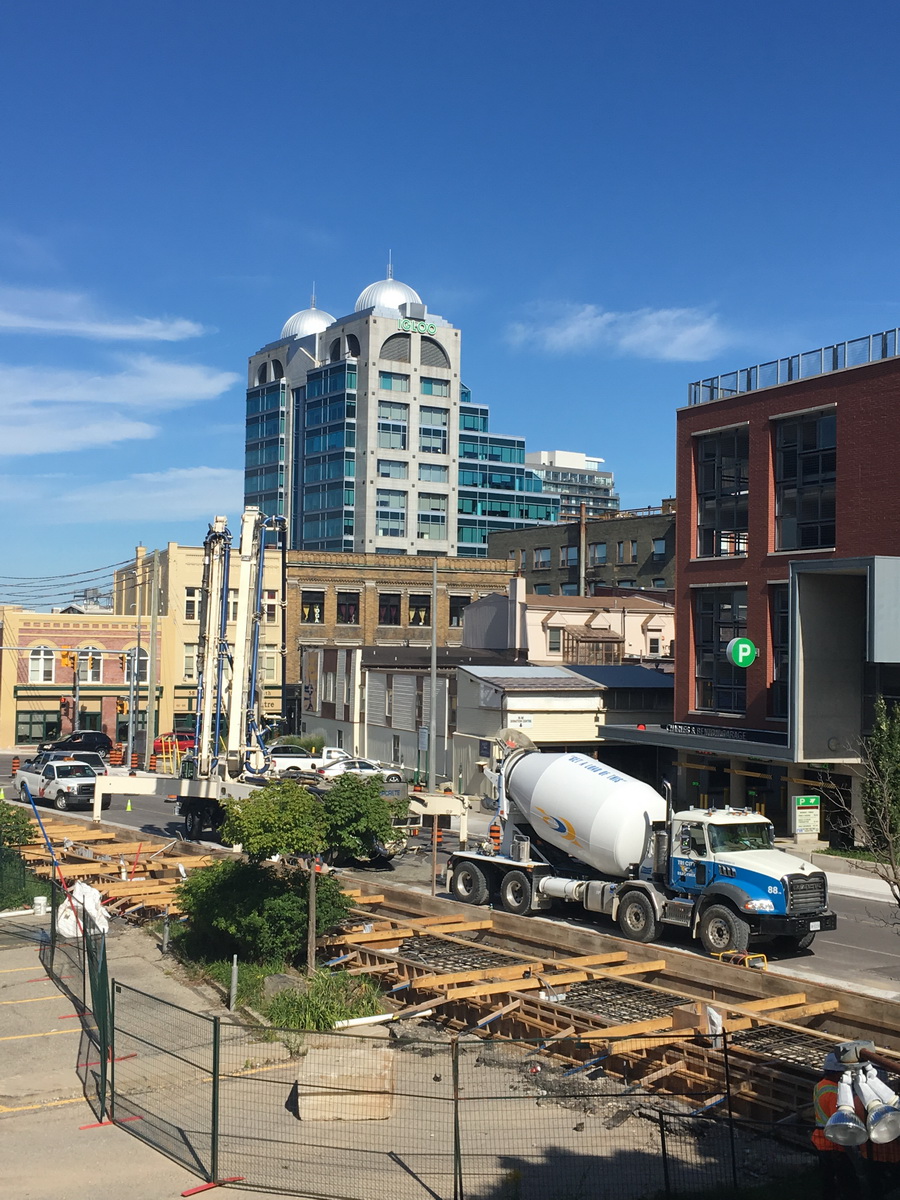
Queen St station platform concrete pour now in progress:

Posts: 6,905
Threads: 32
Joined: Oct 2014
Reputation:
224
(09-09-2016, 10:01 AM)goggolor Wrote: They've dug small trenches around the tracks, preparing to pour concrete maybe? Hopefully whatever work they're doing will also include repaving the Laurel Trail between Seagram and University, which has been out of commission all summer.
A bit rough, perhaps, but certainly not out of commission. I don't know what it looked like prior to construction (I only became a cyclist in May), but I've used it a couple of times a week since then and it's never been closed. I haven't been over there since Sunday though so I'm not sure where things are at.
Posts: 252
Threads: 1
Joined: Sep 2014
Reputation:
9
(09-09-2016, 12:16 PM)Canard Wrote: (09-09-2016, 10:01 AM)goggolor Wrote: They've dug small trenches around the tracks, preparing to pour concrete maybe? Hopefully whatever work they're doing will also include repaving the Laurel Trail between Seagram and University, which has been out of commission all summer.
A bit rough, perhaps, but certainly not out of commission. I don't know what it looked like prior to construction (I only became a cyclist in May), but I've used it a couple of times a week since then and it's never been closed. I haven't been over there since Sunday though so I'm not sure where things are at.
Yes, I've used it too... but it's officially out of commission, and there are bike detour signs directing cyclists through the adjacent parking lot. Even Google Maps has that span marked as "Laurel Trail (Planned)". It's just weird that it's been left unpaved all summer when it's such a key part of the cycling infrastructure.
Posts: 4,443
Threads: 1
Joined: May 2015
Reputation:
204
(09-09-2016, 01:11 PM)goggolor Wrote: (09-09-2016, 12:16 PM)Canard Wrote: A bit rough, perhaps, but certainly not out of commission. I don't know what it looked like prior to construction (I only became a cyclist in May), but I've used it a couple of times a week since then and it's never been closed. I haven't been over there since Sunday though so I'm not sure where things are at.
Yes, I've used it too... but it's officially out of commission, and there are bike detour signs directing cyclists through the adjacent parking lot. Even Google Maps has that span marked as "Laurel Trail (Planned)". It's just weird that it's been left unpaved all summer when it's such a key part of the cycling infrastructure.
This is part of the problem with the way the project has been conducted. The Laurel trail was kept closed months longer than needed — after the main track work was done and nothing whatsoever was happening, the barriers were still up for months. Then eventually they were removed, so that now there is absolutely no indication that the trail is closed, if indeed it actually is (the existence of detour signs in a location does not indicate that not following the detour signs is entering on closed territory; the detour could be for anything). But of course it hasn’t been re-paved yet, as you note. I don’t find it particularly weird, however — the double standard that applies to active transportation infrastructure is well known.
Then the last few days the Seagram crossing has been closed, including the sidewalks, contrary to at least some of the information that has been sent out. So naturally they opened the crossing immediately south of Seagram station platform, right? Wrong! Although this morning it was open enough that people were taking it.
And while I’m complaining about that location, the park crossing should be moved about 10m further south so as not to be in the gauntlet track segment.
Posts: 7,845
Threads: 37
Joined: Jun 2016
Reputation:
217
(09-09-2016, 02:45 PM)ijmorlan Wrote: I don’t find it particularly weird, however — the double standard that applies to active transportation infrastructure is well known.
This is on point. This is not an unusual situation, this is simply, "yet another example".
(09-09-2016, 02:45 PM)ijmorlan Wrote: And while I’m complaining about that location, the park crossing should be moved about 10m further south so as not to be in the gauntlet track segment.
This is actually a good point! Gauntlet track is 2x at least as bumpy to cross.
Posts: 6,905
Threads: 32
Joined: Oct 2014
Reputation:
224
09-10-2016, 09:09 AM
(This post was last modified: 09-10-2016, 09:10 AM by Canard.)
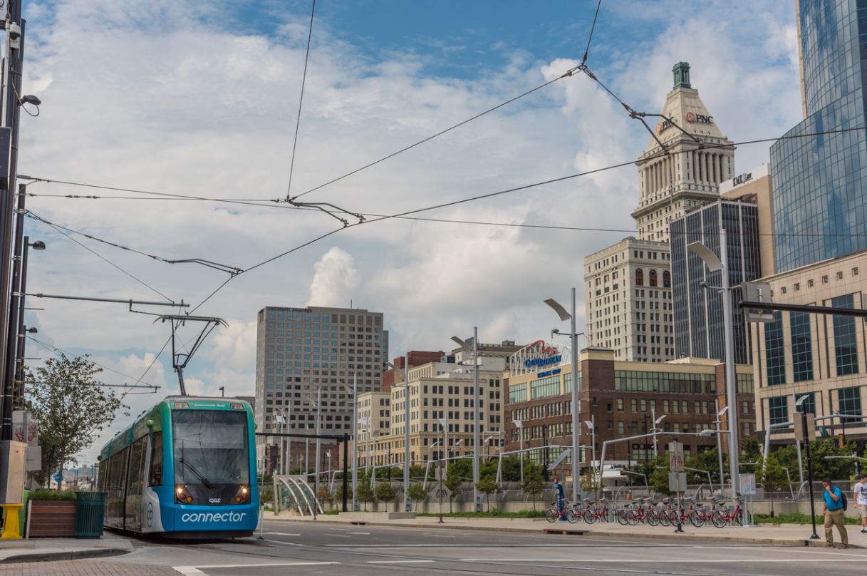
Yesterday, Cincinnati opened their downtown tram line which runs CAF Urbos3 hardware (same as Kansas City). These are great vehicles - very well built.
While I'm not fond of the last-minute sell-out to Cincinnati Bell for naming rights (and the hideous wraps), everything else this line did was right - on-time and under-budget.
Here's a great collection of images from yesterday.
http://cincinnatirefined.com/travel/cinc...ber-9-2016
 (Why I'm posting this here: 1. Let's hope for no last-minute sponsorship deals that will make our trains ugly, and 2. Really hoping for a nice big opening ceremony here as well.)
Posts: 2,015
Threads: 11
Joined: Oct 2014
Reputation:
77
-cat poles getting brackets to attach the catenary support arms along Caroline yesterday
-TPSS site across from GRH has been scrubbed and graded

-are the recently installed curbs at Caroline and Erb in the proper alignment for the forthcoming changes at Caroline/Erb/Albert/Bridgeport realignment or will they have to come out again in 18 months? Those curbs along the north side of Erb do not look to be in the right place/angle
Everyone move to the back of the bus and we all get home faster.
Posts: 10,628
Threads: 67
Joined: Sep 2014
Reputation:
348
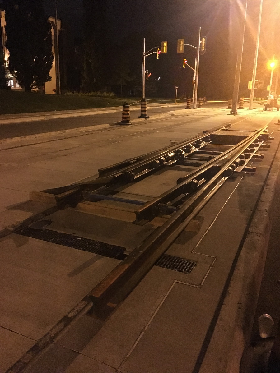
The second switch has appeared at Cameron Heights (yes, it was early this morning ...):

Posts: 2,163
Threads: 17
Joined: Sep 2014
Reputation:
77
(09-10-2016, 11:42 AM)Pheidippides Wrote: -are the recently installed curbs at Caroline and Erb in the proper alignment for the forthcoming changes at Caroline/Erb/Albert/Bridgeport realignment or will they have to come out again in 18 months? Those curbs along the north side of Erb do not look to be in the right place/angle
The Caroline/Erb/Albert/Bridgeport realignment was ordered to work around the planned intersection designs for Caroline/Erb, so the curbs are almost certainly in the "correct" places.
Are they in the ideal places? No.
Posts: 2,015
Threads: 11
Joined: Oct 2014
Reputation:
77
(09-10-2016, 12:12 PM)Markster Wrote: (09-10-2016, 11:42 AM)Pheidippides Wrote: -are the recently installed curbs at Caroline and Erb in the proper alignment for the forthcoming changes at Caroline/Erb/Albert/Bridgeport realignment or will they have to come out again in 18 months? Those curbs along the north side of Erb do not look to be in the right place/angle
The Caroline/Erb/Albert/Bridgeport realignment was ordered to work around the planned intersection designs for Caroline/Erb, so the curbs are almost certainly in the "correct" places.
Are they in the ideal places? No.
I just had a look at the final Caroline/Erb/Albert/Bridgeport drawings and from what I can recall everything looks correct; its that weird parking in front of knox and fake-non-lane that makes everything seem to be configured oddly. Thanks.
Everyone move to the back of the bus and we all get home faster.
Posts: 6,905
Threads: 32
Joined: Oct 2014
Reputation:
224
New signage on Borden; 3 signs in a row prior to hitting the IHT, warning of the trail interface. Very interesting! I assume these are for LRV drivers, which is why I think it's weird: they'll be trained to know this is here, and will know it's there after 2 or 3 runs... So signs are unnecessary. So maybe they're for motorists? I'll have to see if they're there too from the other direction. We were just passing by so I didn't get a good look.
Posts: 4,526
Threads: 16
Joined: Aug 2014
Reputation:
139
|


![[Image: oA1MfaG.jpg]](http://i.imgur.com/oA1MfaG.jpg)
![[Image: vgOt4Ae.jpg]](http://i.imgur.com/vgOt4Ae.jpg)
![[Image: zGEjR19.jpg]](http://i.imgur.com/zGEjR19.jpg)