10-14-2017, 10:49 AM
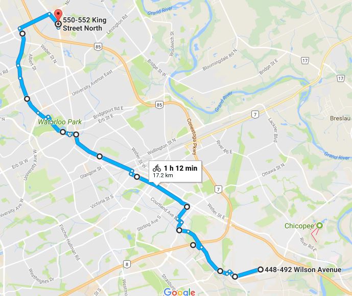
Someone was asking about what route I take to cycle along the entire LRT line; I thought I'd share here, too. Here's approximately the route I usually take:
https://goo.gl/maps/YyDGtDgv8Nk

The only spots that are a little hairy are (from South to North):
I'm also curious as this says 17 km, not 19 km - I guess they count all the track separately in the split sections?!
https://goo.gl/maps/YyDGtDgv8Nk
The only spots that are a little hairy are (from South to North):
- Courtland, between where the Hydro Right-of-Way ends, and Hayward - I typically just go along Traynor here, or I walk my bike on the sidewalk
- The Mill/Ottawa interface is terrible - be really careful, here
- Victoria, between Charles and King - I generally cheat and ride up the sidewalk here for a block
 Sorry
Sorry
- King, between Northfield and Conestoga - the MUT isn't finished on the West side, but it's certainly passable (my bikes aren't true mountain bikes, but it's not so rough that it's impossible)
I'm also curious as this says 17 km, not 19 km - I guess they count all the track separately in the split sections?!


