Posts: 1,101
Threads: 6
Joined: Aug 2014
Reputation:
99
Its been a while since I've seen him out there.... but yup, he was doing great business for a long time! I can only assume he has found a better fishing hole, but I have gotten into the habit of looking along the fence line before I approach the stop sign just in case....
Coke
Posts: 7,735
Threads: 36
Joined: Jun 2016
Reputation:
212
(08-23-2017, 12:37 PM)ijmorlan Wrote: (08-23-2017, 11:53 AM)UrbanCanoe Wrote: Looks odd now, but it appears this is future proofing the intersection as an entrance to the Sixo development. Though I'll still chuckle every time I walk through until that development begins. 
Either the lights should be bagged, or they should be programmed to display a walk signal all of the time. There is no justification for displaying a stop signal for pedestrians and it is wrong to do so. In principle I’d love to hear an expert explanation for why what they’ve done is reasonable, but I’m quite confident there isn’t one.
One thing I’ll be interested to see is whether they use that as the construction entrance. If construction starts with excavation at that end of the property, they could get a construction entrance running through there very quickly. If that happens, then the lights would become reasonable at that point.
Definitely.
(08-23-2017, 12:38 PM)Coke6pk Wrote: Its been a while since I've seen him out there.... but yup, he was doing great business for a long time! I can only assume he has found a better fishing hole, but I have gotten into the habit of looking along the fence line before I approach the stop sign just in case....
Coke
You could also just, you know....stop at the stop sign.
Posts: 4,406
Threads: 1
Joined: May 2015
Reputation:
189
(08-23-2017, 01:48 PM)danbrotherston Wrote: (08-23-2017, 12:38 PM)Coke6pk Wrote: Its been a while since I've seen him out there.... but yup, he was doing great business for a long time! I can only assume he has found a better fishing hole, but I have gotten into the habit of looking along the fence line before I approach the stop sign just in case....
Coke
You could also just, you know....stop at the stop sign.
That is true as a workaround but it doesn’t mean the stop sign should be there or that the police behaviour is reasonable.
Posts: 6,905
Threads: 32
Joined: Oct 2014
Reputation:
224
Posts: 1,101
Threads: 6
Joined: Aug 2014
Reputation:
99
(08-23-2017, 02:32 PM)ijmorlan Wrote: (08-23-2017, 01:48 PM)danbrotherston Wrote: You could also just, you know....stop at the stop sign.
That is true as a workaround but it doesn’t mean the stop sign should be there or that the police behaviour is reasonable.
And sometimes I do.... [if I am being honest, most times I likely roll thru]. I know its the law, and if I got a ticket, I'd pay it. Doesn't mean I have to agree with it.
Coke
Posts: 7,735
Threads: 36
Joined: Jun 2016
Reputation:
212
09-24-2017, 07:53 PM
(This post was last modified: 09-24-2017, 08:00 PM by danbrotherston.)
About two weeks ago, I went biking around Mont-Tremblant Quebec. I've biked there before, every time I'm amazed at how pleasant biking is in the area.
Mont-Tremblant is probably very good for Quebec in general, given that they host the Iron Man, which includes a long bike race, but I get the impression, that many places in Quebec are very very good for biking (not just in Montreal).
There are a substantial number of trails, most of which are paved (except for the Petit-Train-du-Nord outside of Mont-Tremblant down to Montreal, and up to Labelle). You can reach pretty much all of the municipalities within the Mont-Tremblant area by bike pretty comfortably, as well as most of the major municipalities along the Autoroute Laurentides via the Petite-Train-du-Nord, and the ones I've seen have some bike infra.
And the cycling friendliness is not restricted to trails. Many roads have a great deal of effort put into being very cycling friendly. Some roads have wide shoulders, but others have very prominent signage, and restricted speeds. Within villages this is especially apparent and 30km/h zones are very common. Moreover, there seems to be a big effort put into continuity of routes. Signage isn't so clear for destinations, but I didn't encounter any situations where I had to look for the continuation of a trail.
Pedestrian crossings are also well marked and frequent. Additionally, the major highway in the area is bypassed around towns, which means most of the village centres don't have a huge amount of traffic, and when added to the 30km/h the area is very pleasant to be a pedestrian or cyclist in.
From the people I spoke too (or Tess spoke French too) on our trip, much of this is as a result of provincial funding. This matched what I saw which showed provincial roads to both have good infrastructure, and as not serving as an impediment to cycling. This is a substantial shift from Ontario, where the province seems to be a substantial obstacle to cycling, and municipalities have largely taken the lead. Perhaps this will change with the new CycleON policies.
I'm also told there is a lot of mountain biking, and we saw some evidence of this, but as it is not in my skillset, I didn't partake can cannot review.
It is worth noting, the area is still very car oriented. The primary target of this infrastructure appears to be recreational cyclists. While I can totally imagine staying there with only a bike, I suspect most people still have cars. I saw very many vehicles with bikes on the back. The areas are still fairly far apart. Although, given the area mostly is a recreational area, I guess this is not surprising.
Our routes:
https://drive.google.com/open?id=1sN-QH9...sp=sharing
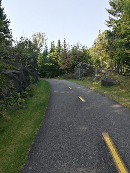
Here's an example of trails in the Mont-Tremblant area. While cycling might be reasonably good in Quebec, this is truly exemplary. Wide (at least 4 meters, more around corners), paved trail with good signage, and, *gasp* substantial blasting (and filling) to level the trail somewhat. Given it's a mountainous area, there is still a lot of climbing, but this seems like a huge luxurious expense for cycling infrastructure. And keep in mind, this particular trail is not a rail trail. This blasting was done just for the trail.
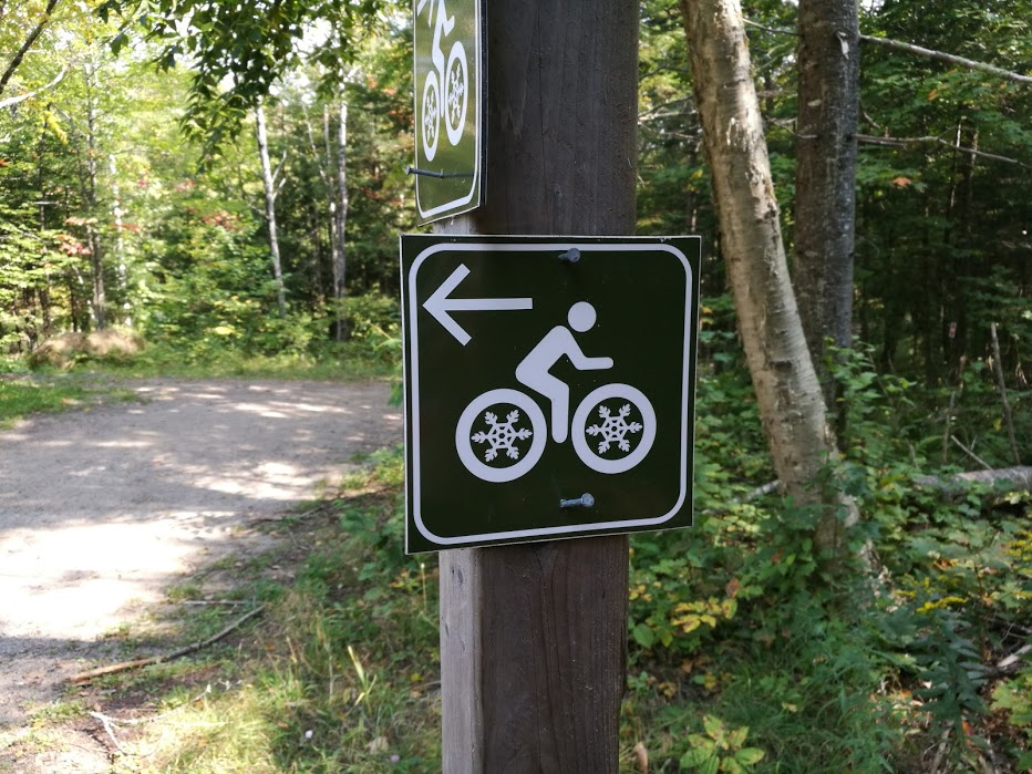
I'm not sure if this sign is intended to convey winter biking routes or not.
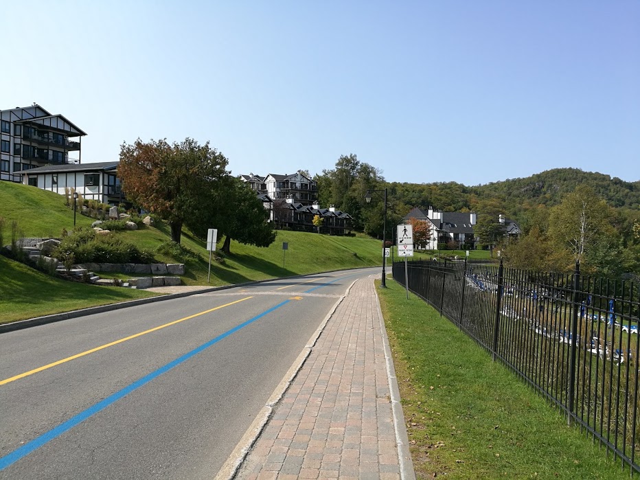
This image is from the waterfront, which is another 30km/h zone, with many pedestrian crossings (like the one pictured), where pedestrians have the right of way (legally and in practice) there is a sign marking it as well. On faster wider roads, the crossing will be marked with a sign in the middle of the road as well. The blue line is marking the course for the Iron Man.
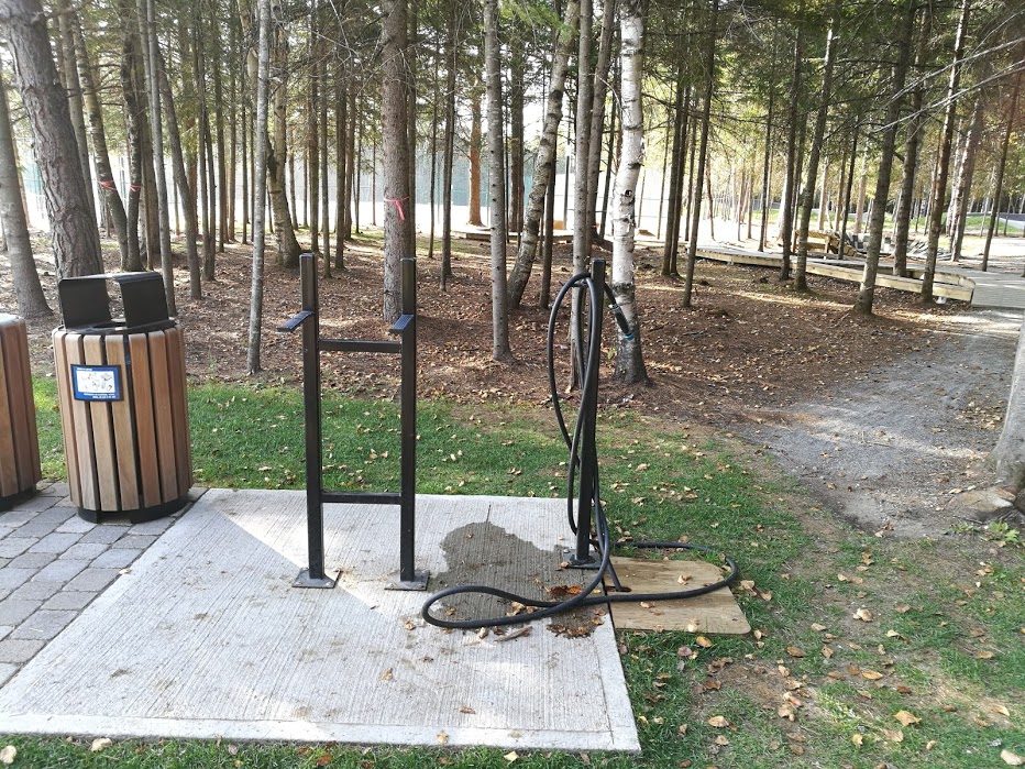
Here is a substantial bike repair/washing station near the mountain biking skills park. There's also garbage and recycling (which are also very common in the municipality). I thought the washing station was interesting as well.
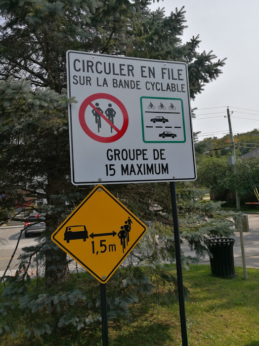
Mont-Tremblant had these signs in several places, single file is a bit disappointing, but limiting groups to *only* 15 is huge, and requiring 1.5 meters when passing also beats Ontario.
Posts: 7,735
Threads: 36
Joined: Jun 2016
Reputation:
212
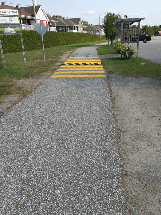
This is the Petit-Train-du-Nord at the north end (north of Labelle), it's not terribly wide, but given how far north it is, it probably doesn't matter. This is a speed bump entering the former station area (it's a rail trail) which is now a rest stop with water, bike racks, and various other amenities. It is strange that the lesser used northern portion of the trail is paved though.
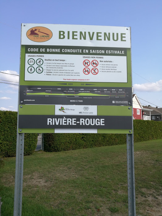
These signs can be found all along the Petite-Train-du-Nord. There is a lot of detail including elevation information.
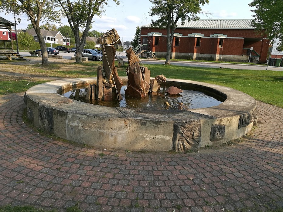
Some station area artwork.
A very enjoyable area to bike, and between the language barrier, the bike infrastructure, and the villages, it sure feels more like touring in Europe than Ontario.
Posts: 1,317
Threads: 2
Joined: Sep 2014
Reputation:
41
Cool post, I will add the Mt. Tremblant area to my plans for eastern Canada.
I was just riding around Manitoulin and the Bruce Peninsula. Highway 6 has a small paved shoulder but it's so cracked that it's like riding cobblestones, and many stretches of the shoulder are full of these weird rumble strips that are as wide as the shoulder but not as deep as the machined kind that run along the 401, these look more like they were rolled in the asphalt. On the island the province is repaving a long stretch of highway 540 but they aren't putting any paved shoulders on it despite it being one of the busier highways. Half of highway 6 on the island also lacks a paved shoulder and it's the busiest half of the highway. North of the island the shoulders along 6 were much nicer when I was through there in 2011. Bruce county does a better job of paving wide shoulders on the county roads, even though the northern part of the county has really low traffic on the side roads.
After riding out in BC and Alberta this summer I've come to think that the MTO just hates paved shoulders. They're better for motorists and road life too, it's not just for cyclists.
Posts: 1,101
Threads: 6
Joined: Aug 2014
Reputation:
99
10-02-2017, 02:23 PM
(This post was last modified: 10-02-2017, 02:23 PM by Coke6pk.)
Went for a walk this week over the bridge to Gatineau, and again was impressed with the cycling infrastructure in the NCR.
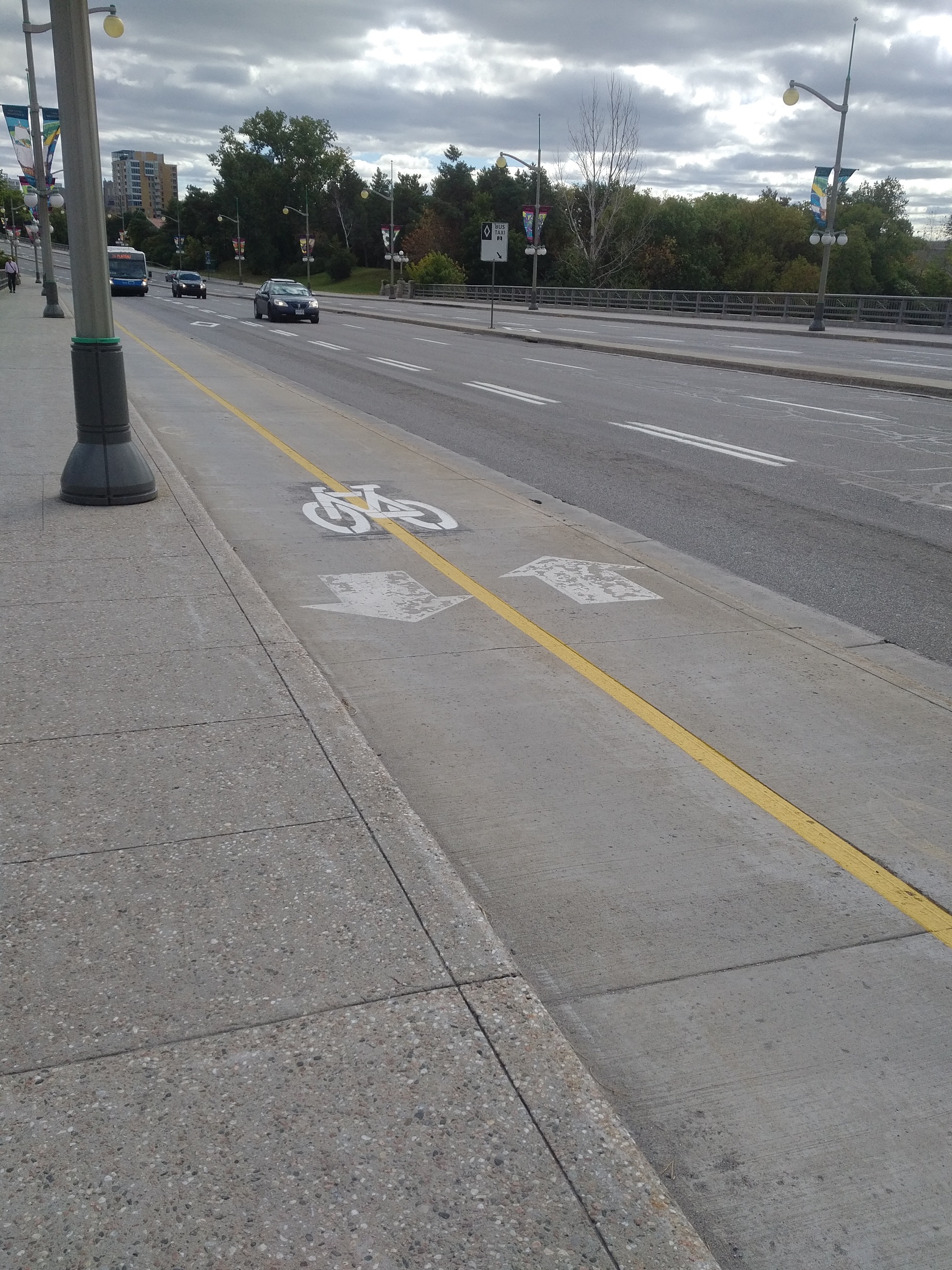
"Grade" separation from each the roadway, bikeway and sidewalk!
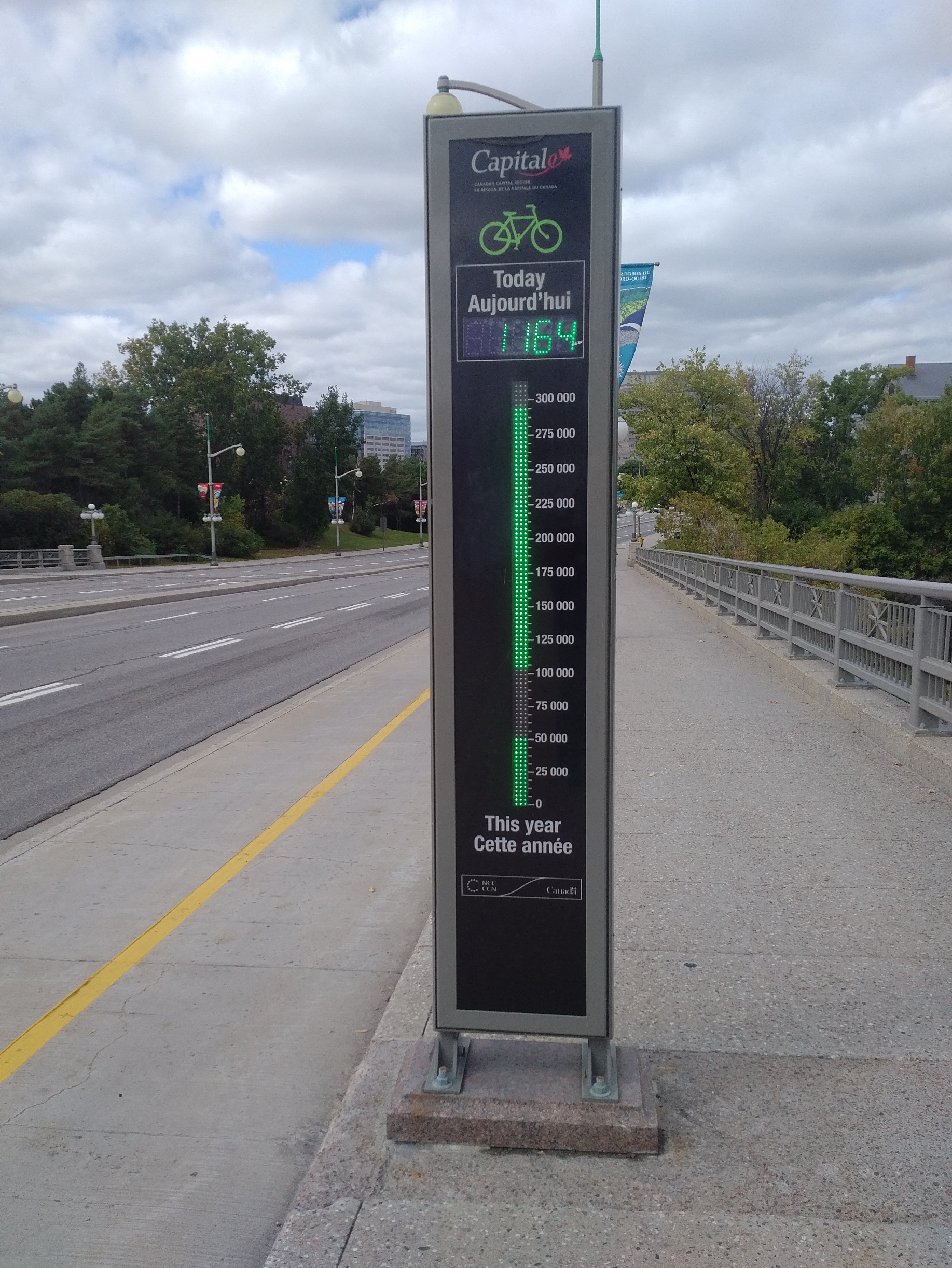
Even the counters are way more fun!
Coke
Posts: 6,905
Threads: 32
Joined: Oct 2014
Reputation:
224
Posts: 617
Threads: 7
Joined: Nov 2015
Reputation:
20
I'm visiting Beijing this week. I thought I'd share my observations.
First, the are a lot of bike share bikes. I had heard that there were a lot of them, but I was still surprised. The two biggest operators are both stationless, so people leave the bikes wherever they finish using them. It's rare to go more than 20m without seeing at least one shared bike available, and there will often be 20-30 lined up at a major intersection.
Second, the road layout is generally good for cycling. Most roads have what could be described as semi-segregated bike lanes. There will be two or three traffic lanes, then a boulevard with a fence, trees and often flowers, then a lane used by bicycles, motorbikes, small delivery vehicles and cars going to a parking space. That lane will have parallel parking and the entrance to any small parking lots. Larger lots for apartment complexes or large businesses will have turn offs directly from the traffic lanes. It's very similar to Belmont going through Belmont Village, but with bikes moved into the same lane as cars looking for parking.
Posts: 7,735
Threads: 36
Joined: Jun 2016
Reputation:
212
(10-03-2017, 09:44 PM)jwilliamson Wrote: I'm visiting Beijing this week. I thought I'd share my observations.
First, the are a lot of bike share bikes. I had heard that there were a lot of them, but I was still surprised. The two biggest operators are both stationless, so people leave the bikes wherever they finish using them. It's rare to go more than 20m without seeing at least one shared bike available, and there will often be 20-30 lined up at a major intersection.
Second, the road layout is generally good for cycling. Most roads have what could be described as semi-segregated bike lanes. There will be two or three traffic lanes, then a boulevard with a fence, trees and often flowers, then a lane used by bicycles, motorbikes, small delivery vehicles and cars going to a parking space. That lane will have parallel parking and the entrance to any small parking lots. Larger lots for apartment complexes or large businesses will have turn offs directly from the traffic lanes. It's very similar to Belmont going through Belmont Village, but with bikes moved into the same lane as cars looking for parking.
This arrangement is used in the Netherlands in places as well. In fact, service roads aren't uncommon here as well. The difference is that in the Netherlands is that cars are prevented from using the service road as a through street, and are forced back to the main road every block, where as cyclists are provided a cycle path to continue to the next service road. This prevents the situation which occurs in some places here where the service road becomes a shortcut for those angry about traffic on the main road and simply serves as more lanes of high speed traffic. To be honest, the same effect could almost be achieved with some of our roads and the continuous strip mall/plazas they have along them lol.
Posts: 4,472
Threads: 16
Joined: Aug 2014
Reputation:
132
The Dutch have such a wide spectrum of road uses that they are very accustomed to - and there's a consistent use of roadway design, pavement marking and signage that it's very intuitive as well.
One of my favourite signs is used in woonerfs and other limited-car-access areas: 'Auto te Gast' - 'Cars are Guests'.
Posts: 6,905
Threads: 32
Joined: Oct 2014
Reputation:
224
I'd heard the stationless bikes in China were actually a really big problem:
Posts: 7,735
Threads: 36
Joined: Jun 2016
Reputation:
212
10-09-2017, 12:25 PM
(This post was last modified: 10-09-2017, 12:26 PM by danbrotherston.)
https://drive.google.com/open?id=1JXGhYv...sp=sharing
This weekend, as usual for thanksgiving I went to visit some family in Scarborough. Usually, we take the GO Bus to Square One, then another to Union, then the train out to their place in Scarborough. This year, we thought instead we would bike part of the journey.
Taking a look at Google's bike map, there appeared to be a fairly reasonable trip most of the way.
From Square One, after working our way through the mall (which do not underestimate, that place is nutso), the trail along Burnhamrthorpe is pretty reasonable. Wide, and far from the road. The only problems are the usual ones of no legal (or actual) safety at intersections, as well as annoying on a road bike curbs.
The trail eventually diverts up along Etobicoke creek, towards centennial park. Sadly, this section of the trail was under construction so aside from soft sand and some diversions, we eventually made it to Eglinton, which has a brand new bike path along the Mississauga Transitway. Sadly, a little too brand new as it wasn't quite finished in a few places. Still, we managed to cross under the 427 in relative safety. Some of the intersections even have bike signals, and all have legalish marked crossings. We followed this path all the way to the Humber River, where we were able to take the recreational path all the way down to the Waterfront path, which we could then follow to downtown.
The waterfront path was quite good, suitable for high speed, separated mostly from pedestrians and cars, and with many bike signals and level crossings. It was by far the best infrastructure of the trip. The Humber river path was not so good, very narrow at places, on road in others. While it works, it wasn't comfortable, and I doubt it is for pedestrians either.
Downtown we found a surprising network of infrastructure. The lanes on Sherborne were pretty good (although it's apparent to me that roll curbs are insufficient from preventing bike lane parking), and then up to the Bloor St. bike lanes. I really hope they keep them, they're not without issue, but Bloor is a vastly better street with them. As I kind of expected in Toronto, there were a number of dangerous interactions, mostly right hooks, one Uber driver blindly pulling into a bike lane and just about wiping out 4 cyclists simultaneously.
After that, we managed to find our way to the Don River Path, which is...not the best, really, for anything. The DVP is very close, so it's extremely noisy, it's very narrow, and the access we used involved a very long flight of steps. I found it rather stressful to use. Still, it was functional, but I find it ironic that it's a recreational path, given how unpleasant the noise is--maybe Torontonians are just use to the noise.
Then we continued east along the Waterfront trail, which is pretty good for a while (a bit noisy along Lakeshore) but approaching the Toronto Hunt (golf course), things pretty much fall apart. You're forced up to Queen which has streetcar tracks and parked cars, plus plenty of traffic. Not a great place to cycle. Eventually onto Kingston Rd., which has substantial traffic, and a (partially) continuous bike lane, but only in the Eastbound direction. I have no idea what westbound trail users are supposed to do. Past the golf course, the trail winds it's way through side streets which is reasonably comfortable, but pretty slow. Much better thank Kingston Rd.
Overall, I was surprised and impressed how possible the bike ride was. I'm not keen on riding in Toronto traffic, but basically to get downtown, or even east of Downtown from Square One, it wasn't required at all. And downtown has a surprising array of infrastructure. It has changed quite a bit since I lived there. There were a lot of people using the infrastructure in downtown Toronto, but very few in farther out areas, or in Mississauga. I guess this is to be expected, but in the areas we were in, the infra was probably acceptable for most "cautious but interested" or whatever they call them too cycle. Still, we had to pick our route carefully. It was largely continuous, but often poorly marked, and it was probably a dozen KMs. out of our way from the most direct route.
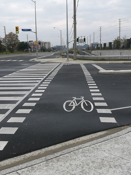
Also, why no bike symbol traffic lights I wonder?
|


