Posts: 10,280
Threads: 65
Joined: Sep 2014
Reputation:
296
(02-15-2016, 11:12 AM)BuildingScout Wrote: (02-15-2016, 09:50 AM)jamincan Wrote: I don't know what the official definition is, but I'd consider the area between William and Central as Uptown.
The Uptown BIA includes, quite naturally, all the businesses between John and Central on King+side streets .
I think Uptown BIA's definition is as official as it gets!
Posts: 2,402
Threads: 7
Joined: Aug 2014
Reputation:
48
Posts: 1,312
Threads: 2
Joined: Sep 2014
Reputation:
40
I'm looking forward to seeing what they end up doing with the old brewery part of the building... it would be neat to see it converted into another brewpub if the local market could bear another one; I don't really know what the scene is like these days.
Posts: 2,002
Threads: 7
Joined: Sep 2014
Reputation:
124
The point stands, though, that it's not like they're putting a tall building at the corner of King and Erb. The character of the street is pretty different at this location.
Posts: 10,280
Threads: 65
Joined: Sep 2014
Reputation:
296
(02-15-2016, 12:22 PM)jamincan Wrote: The point stands, though, that it's not like they're putting a tall building at the corner of King and Erb. The character of the street is pretty different at this location.
Yes, it is different: the buildings are much taller south of William. Bauer Lofts is a block away, 144 Park (and its future cousin) are on the next street, Sun Life is a few blocks further south. And even Allen Square, Red and Cortes are taller than anything that's around Erb or Bridgeport. This would fit in nicely.
Posts: 4,912
Threads: 155
Joined: Aug 2014
Reputation:
118
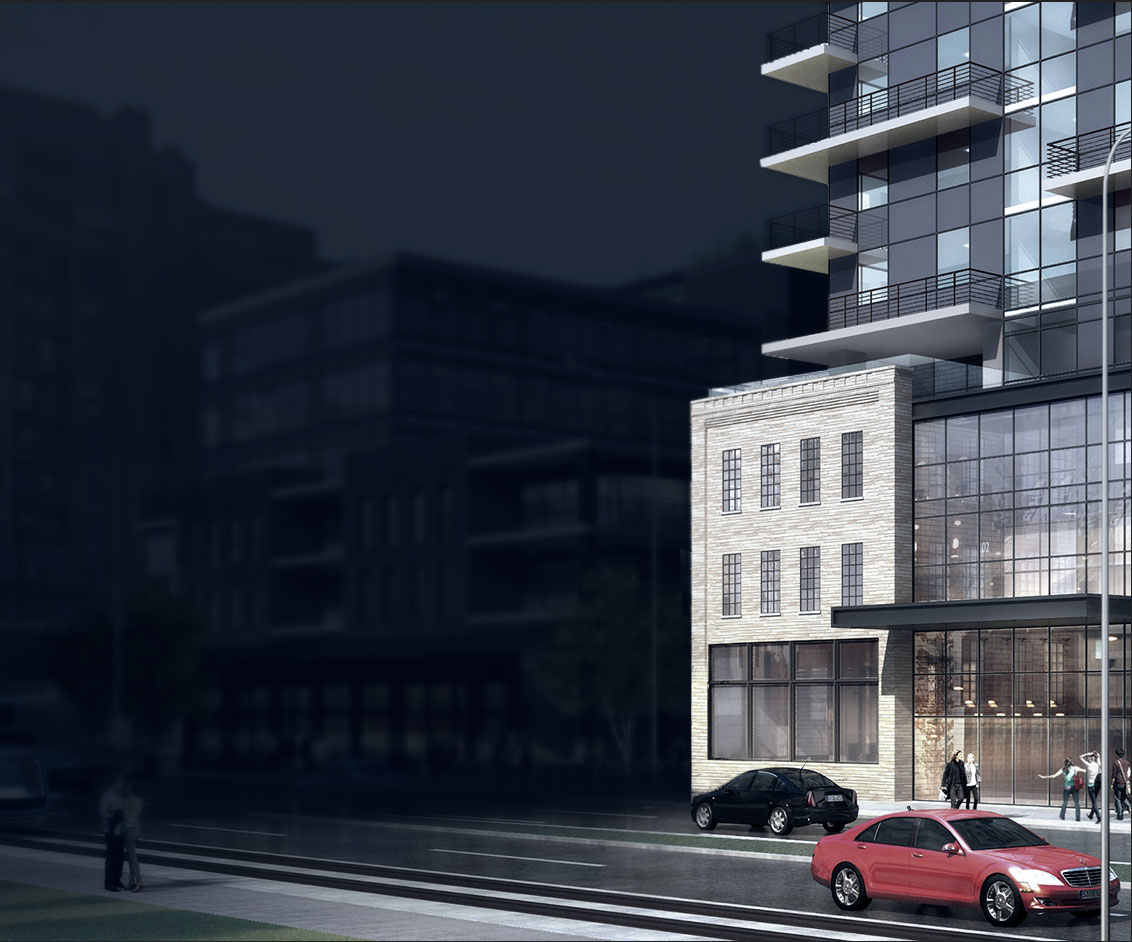
(02-14-2016, 05:51 PM)Lens Wrote: Also, looking at the property line, that render doesn't make much sense. They would only have a few meters to the left of the original facade to build on. Maybe they're planning on disassembling and moving it to the right?
That would make the most sense. Particularly given the rendering, it looks like it's only the facade being used, not the building itself.
Posts: 6,470
Threads: 38
Joined: Aug 2014
Reputation:
87
(02-15-2016, 01:50 PM)Spokes Wrote: (02-14-2016, 05:51 PM)Lens Wrote: Also, looking at the property line, that render doesn't make much sense. They would only have a few meters to the left of the original facade to build on. Maybe they're planning on disassembling and moving it to the right?
That would make the most sense. Particularly given the rendering, it looks like it's only the facade being used, not the building itself.
That was my reaction at first, but I'm not sure - the render seems to show the reflecton of side wall windows in the interior. The render seems to fudge things a bit, which could suggest façade preservation only.
Posts: 278
Threads: 4
Joined: Aug 2014
Reputation:
5
Looks to me like they are keeping the old building - can see the side windows inside the new glass. I would say it was mirrored to frame their page properly - even looks a bit like the Bauer building in the background there.
Posts: 430
Threads: 2
Joined: Jun 2015
Reputation:
50
(02-15-2016, 03:13 PM)notmyfriends Wrote: I would say it was mirrored to frame their page properly
That would explain the cars driving on the left.
Posts: 10,280
Threads: 65
Joined: Sep 2014
Reputation:
296
(02-15-2016, 08:57 PM)kps Wrote: (02-15-2016, 03:13 PM)notmyfriends Wrote: I would say it was mirrored to frame their page properly
That would explain the cars driving on the left.
Awesome! I can't believe no one else (including me) spotted that ...
Posts: 278
Threads: 4
Joined: Aug 2014
Reputation:
5
The view in my browser didn't show cars so I had no idea what you were referencing, then I pulled up the source
http://www.hipdevelopments.com/sites/def...copy_0.png
Posts: 1,312
Threads: 2
Joined: Sep 2014
Reputation:
40

Ah that makes sense now. I didn't see cars in my browser either.
Posts: 262
Threads: 3
Joined: Aug 2014
Reputation:
22
(02-14-2016, 10:33 PM)Lens Wrote: I would consider it on the border of Uptown and Midtown. This is a little boundary map I made to define midtown:
Perhaps we need an area for this district. Upper Midtown. Midder Uptown. Muptown. Diptown.
Posts: 1,189
Threads: 0
Joined: Mar 2015
Reputation:
34
(02-16-2016, 09:55 AM)zanate Wrote: (02-14-2016, 10:33 PM)Lens Wrote: I would consider it on the border of Uptown and Midtown. This is a little boundary map I made to define midtown:
Perhaps we need an area for this district. Upper Midtown. Midder Uptown. Muptown. Diptown.
Unionville.
Posts: 1,709
Threads: 2
Joined: Aug 2014
Reputation:
34
The pleasantness gulf that exists from Sunlife to the GRH parking lot is a good way to conceptually break up UpTown and Midtown. Yes, the northeast side isn't as dull, but still.
|


