Posts: 2,865
Threads: 3
Joined: Mar 2015
Reputation:
95
(07-29-2020, 07:53 PM)kitborn Wrote: Weber and Frederick. A repurposed mansion that has been re-painted looks good with background.
Well, damn, that courthouse truly is a monstrosity. You'd get lost in the bowels of justice in that place real fast. One wrong turn, game over, you're headed to the Milton Hilton for the rest of your life.
Posts: 1,700
Threads: 3
Joined: Oct 2014
Reputation:
128
Very nice pictures Tom, thank you for sharing.
Posts: 10,275
Threads: 65
Joined: Sep 2014
Reputation:
296
Posts: 996
Threads: 21
Joined: Aug 2014
Reputation:
60
Very nice. The last pic of Victoria Park is beautiful.
Posts: 1,313
Threads: 22
Joined: Apr 2016
Reputation:
102

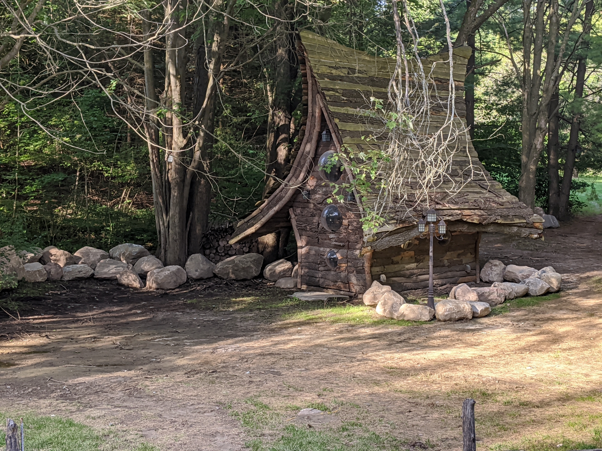
On Wilmot Line, Waterloo.
Posts: 6,469
Threads: 38
Joined: Aug 2014
Reputation:
85
(08-17-2020, 06:13 PM)Acitta Wrote: On Wilmot Line, Waterloo. On a private property?
Posts: 1,313
Threads: 22
Joined: Apr 2016
Reputation:
102
(08-17-2020, 06:53 PM)panamaniac Wrote: (08-17-2020, 06:13 PM)Acitta Wrote: On Wilmot Line, Waterloo. On a private property? Yes, as far as I know.
Posts: 7,579
Threads: 36
Joined: Jun 2016
Reputation:
196
Well, this is not my picture, but someone on reddit posted a screencap of the new Microsoft Flight Sim 2020 flying over DTK.
Very cool! Surprisingly accurate and an amazing obvious in hindsight idea for a video game.
That being said, the data, while impressive, seems to have considerably more errors than Google Maps 3D data. I'm guessing that neither Google nor MS have bothered with human interventions for a city like KW, so we can see the relative effectiveness of each of their algorithms.
(Also, I'd love for this type of data to be available for more video games).
Posts: 10,275
Threads: 65
Joined: Sep 2014
Reputation:
296
Posts: 252
Threads: 1
Joined: Sep 2014
Reputation:
9
This is a copy someone annotated with street and building names: ![[Image: 9l34POL.jpg]](https://i.imgur.com/9l34POL.jpg)
Posts: 7,579
Threads: 36
Joined: Jun 2016
Reputation:
196
(08-25-2020, 10:32 PM)tomh009 Wrote: Link? Or photo?
Oh my goodness...sorry about that...can't believe I did that.
I even still have the link in my past buffer this morning:
https://i.redd.it/ten08pvcszh51.png
It is the un-annotated version that gogglor posted though, so.
Posts: 10,275
Threads: 65
Joined: Sep 2014
Reputation:
296
Thanks 
Posts: 1,971
Threads: 18
Joined: Aug 2014
Reputation:
37
(08-26-2020, 09:45 AM)danbrotherston Wrote: (08-25-2020, 10:32 PM)tomh009 Wrote: Link? Or photo?
Oh my goodness...sorry about that...can't believe I did that.
I even still have the link in my past buffer this morning:
https://i.redd.it/ten08pvcszh51.png
It is the un-annotated version that gogglor posted though, so.
Wow I could have believed that was an actual picture.
Posts: 7,579
Threads: 36
Joined: Jun 2016
Reputation:
196
[attachment=7266 Wrote:plam pid='83531' dateline='1598487604'] (08-26-2020, 09:45 AM)danbrotherston Wrote: Oh my goodness...sorry about that...can't believe I did that.
I even still have the link in my past buffer this morning:
https://i.redd.it/ten08pvcszh51.png
It is the un-annotated version that gogglor posted though, so.
Wow I could have believed that was an actual picture.
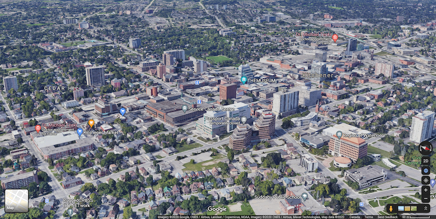
FWIW This is the Google Maps 3D image.
Some of the limitations are due to my poor suffering Intel integrated graphics...plus slow loading so many textures in real time (and image compression).
Ignoring all that, the trees and foliage seem to look better in the Microsoft image, which makes sense I think they've focused on that a lot.
But the building geometry is far better in Google.
Still, very cool that we can get these kinds of models now. I'd love to be able to drop my Zwift bike into the virtual actual world.

Posts: 1,515
Threads: 13
Joined: Aug 2014
Reputation:
123
08-27-2020, 01:49 AM
(This post was last modified: 08-27-2020, 01:50 AM by taylortbb.)
(08-26-2020, 10:08 PM)danbrotherston Wrote: Ignoring all that, the trees and foliage seem to look better in the Microsoft image, which makes sense I think they've focused on that a lot.
I think the major reason things like that look better is that Microsoft wasn't going for a fully accurate depiction of the city. Flight Simulator took the building shape data from Open Street Maps (which doesn't have Google's resources), and then just applied (likely automatically) plausible textures. The trees are likely also a high quality tree model, placed plausibly.
Google Maps textures everything with real satellite photography, and attempts to accurately capture what trees exist in the real world. Makes sense for the different use case, but results are unsurprisingly totally different. Looking good vs accuracy.
The OSM data is how Flight Simulator ended up with a 212 storey house in suburban Melbourne.
https://www.engadget.com/flight-simulato...45509.html .
|


![[Image: 9l34POL.jpg]](https://i.imgur.com/9l34POL.jpg)