09-01-2015, 09:29 AM
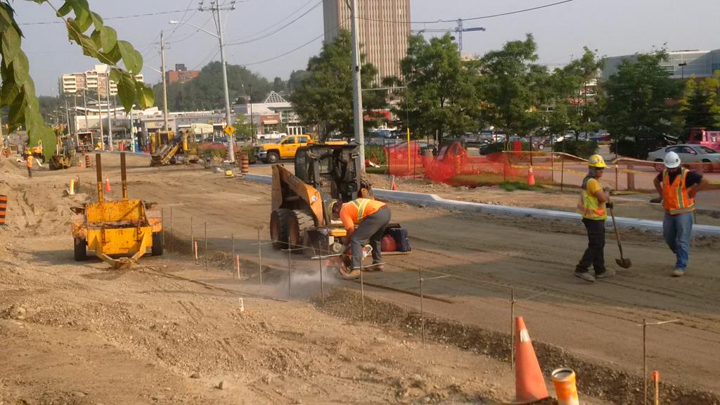
Curbs on Caroline!!!
The 2 years of dirt road is approaching an end!

The 2 years of dirt road is approaching an end!
|
ION - Waterloo Region's Light Rail Transit
|
|
09-01-2015, 09:29 AM
Curbs on Caroline!!!
The 2 years of dirt road is approaching an end!
09-01-2015, 11:01 AM
That'll be nice.
I was looking at the 6 month update from March which suggested that the Erb/Caroline intersection will be done during the summer, so hopefully we'll see movement on that soon.
09-01-2015, 11:29 AM
Yeah, going West on Victoria makes a lot more sense to me.
09-01-2015, 11:48 AM
Going West on Victoria would bring some nice aesthetic value to maps as it will echo the 7/8/85 Conestoga Parkway route in a pleasant fashion.
I'm a little confused as to how it would be placed, though. The road is too narrow for double tracks and grade separation. Alternatively, I wonder how difficult it would be to get the right to widen and redevelop the existing rail segment (and put stops along it).
09-01-2015, 12:58 PM
09-01-2015, 01:09 PM
(09-01-2015, 11:48 AM)chutten Wrote: Going West on Victoria would bring some nice aesthetic value to maps as it will echo the 7/8/85 Conestoga Parkway route in a pleasant fashion. Most of it is four lanes and a turning lane, except for the stretch between Park and Belmont. I wonder what the actual right-of-way is, though- isn't it normal for the municipality to have a rather wide corridor along streets like this, for future widening?
09-01-2015, 01:44 PM
You mean one year, Markster!
09-01-2015, 01:49 PM
(09-01-2015, 01:09 PM)MidTowner Wrote:(09-01-2015, 11:48 AM)chutten Wrote: Going West on Victoria would bring some nice aesthetic value to maps as it will echo the 7/8/85 Conestoga Parkway route in a pleasant fashion. It's to Lawrence, actually. According to the Region's GIS Locator (Silverlight. Eurgh), there's at least 20m between the lots along the narrow stretch (from 286 across to 281 seems narrowest to my eyeballs), and that matches the spacing along the wider stretches as well. So there's no right-of-way reason I can see preventing a Victoria unification (other than I'm not sure they could keep the bike lanes). King St seems to have 25m widths along the LRT portions. That extra space might be necessary.
09-01-2015, 02:26 PM
I wonder what could have cause such long delays on Caroline. No doubt it was one of those freak problem streets where it's just problem after problem, but I'm curious as to the nature of those problems. Infrastructure no where it should be?
Also, what's different about those curbs compared to the ones we saw last week is it just that there's more of them now? IIRC, it's supposed to be all paved by Friday.
09-01-2015, 02:30 PM
Last week, it was curbs south of William, this week it's curbs north of William.
09-02-2015, 10:16 AM
Interesting to see that only one set of tracks was laid across Seagram during the closure.
09-02-2015, 01:16 PM
Is the waterloo park parking lot off seagram open again? Thank you.
09-02-2015, 02:50 PM
09-04-2015, 07:35 AM
(09-02-2015, 10:16 AM)timio Wrote: Interesting to see that only one set of tracks was laid across Seagram during the closure. I have a hunch that this has to do with the close proximity of the Seagram (Waterloo Park) station to the road: Remember that stations along the spur will have Gauntlet Tracks, and perhaps the crews don't have the equipment (switch components, wide ties, non-standard road decking plates) on-site yet to install these. Note that no switches up at the OMSF have been installed yet either. |
|
« Next Oldest | Next Newest »
|